
Mangrove Restoration Bulletin: Quarterly updates from the ground Q2 2026
٢٤ يوليو ٢٠٢٦ /عام
Monitoring takes to the skies
For the past two years, we have been monitoring the success of mangroves planted across the northern Emirates as part of the Mastercard Priceless Planet Coalition. Initially, our monitoring focused on tree survival and growth before evolving to assess ecological integrity: whether restored mangroves are developing into healthy, self-sustaining ecosystems.
Earlier this year, our bird surveys gave us our first glimpse of that recovery through the eyes of wildlife. Birds were returning to the restored area, indicating that the young mangroves were beginning to function as habitat.
This quarter, we added another layer by introducing drone surveys at our Umm Al Quwain restoration site. For the first time, we were able to see our mangroves from above. Across 2 drone flights and over 5 flight hours, we mapped 2 hectares of mangroves.
The aerial perspective helped us piece together more of the story. Not only is the mangrove canopy thriving, but the wider landscape is changing too. By mapping the greenness of every tree, we could see at a glance which patches are thriving and which are lagging – a whole-site health check that would take weeks to piece together on foot..
Seeing the bigger picture
Field surveys remain the backbone of our monitoring programme. They allow us to inspect individual trees, record new seedlings and understand what's happening on the ground. But they can't show us how the restoration site, thanks to our partner Distant Imagery.
is changing as a whole.
That's where drone surveys come in.
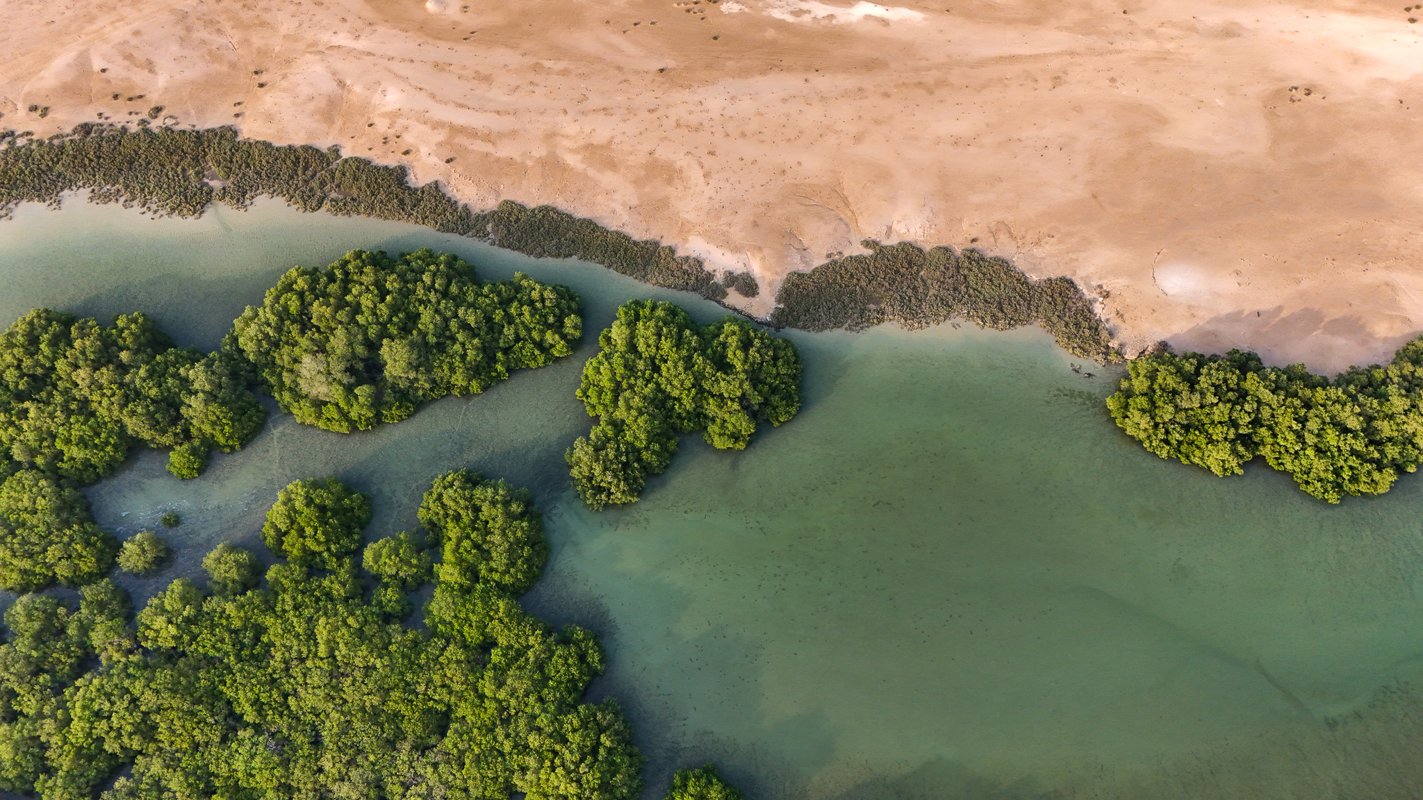
Flying above the mangroves, drones allow us to map every tree, measure canopy health using the level of greenness of the leaves. Mapping this across the whole site reveals which patches are thriving and which are lagging, so we can direct our attention, and our next field visits, to the areas that need it most.
An encouraging discovery
Looking at the restoration site from above revealed something particularly exciting.
The drone can also define the heights of mangroves and the soils, through a process of photogrammetry. This revealed something we couldn't see from the ground: the mangroves doing best are those growing at just the right height on the shore. Low, gently sloping ground where the tide reaches regularly but never lingers too long. Even a few centimetres of elevation can be the difference between a sapling that thrives and one that struggles.
From above, we are seeing that saplings become visible once they reach around 40 centimetres tall, with the smallest and newest hardest to spot. When we cross-check the drone against our field surveys, the canopy area it measures (how much ground each tree's leaves spread across) matches what our teams record on the ground remarkably closely, making it the most reliable reading we get from the air so far. Height is trickier for the youngest saplings, and that's exactly where field data keeps us honest. Neither survey is complete on its own; together they give us the full picture.
Together, they allow us to monitor restoration with greater confidence.
Looking ahead
In the years ahead we'll be watching for the point where our planted sites begin to match the density and structure of a wild, naturally established mangrove forest, a milestone likely more than a decade after planting. Restoration is a long game, and every survey is another step along that path.
The drone data is helping us look forward in a more practical way too. By learning exactly which conditions mangroves establish best, we can map out the most promising ground for future planting. Knowledge that will guide not just this site, but restoration projects across the UAE.
Over the coming quarters, we will continue combining field observations with aerial monitoring and biodiversity surveys to track the long-term development of these restoration sites.